Secluded bays and idyllic nature. The Fishermen’s Trail in Portugal winds along the Atlantic coast for more than 200 kilometers – a dream for hikers.
In the south of Portugal, the Trilho dos Pescadores, also known as the “Fishermen’s Trail”, beckons along the Atlantic coast. From village to village, through the Alentejo and Algarve regions, the hiking trail leads past steep cliffs and dream beaches – including impressive panoramas and untouched natural landscapes.
Trilho dos Pescadores: secluded bays and tranquil villages
After the first day of hiking, one thing is clear: this trail along Portugal’s Atlantic coast in the Alentejo is not for beach lovers. They would suffer and hardly make any progress. Because even on the long sandy beach of São Torpes south of the coastal town of Sines, one of the starting points of the trail, hikers actually want to spend hours playing in the waves or sunbathing instead of putting on their rucksack and setting off on a hike.
Praia de Morgavel, Praia do Burrinho, Praia da Samoqueira – hikers pass all these secluded bays and picture-book beaches on the starting stage to Porto Covo. Simply walking past them is almost impossible – and yet there is no alternative. There are no overnight accommodations between the few fishing villages that mark the day’s stages.
Surf spots on the Fishermen’s Trail in Portugal
Surfers should also avoid the fishing path, the “Trilho dos Pescadores”, jokes Lukas from Germany. He and a friend have been driving along the Atlantic coast between Porto Covo and the Cape of São Vicente on the extreme south-western tip of Portugal in a motor-home for two weeks now. “This is simply the best surfing hotspot in Europe. You have good waves all year round and there are hardly any surfers in the water. And look at this empty dream beach,” he says, pointing down from the cliff where they are staying in their camper van to the surfing beach of Malhão, south of Porto Covo.
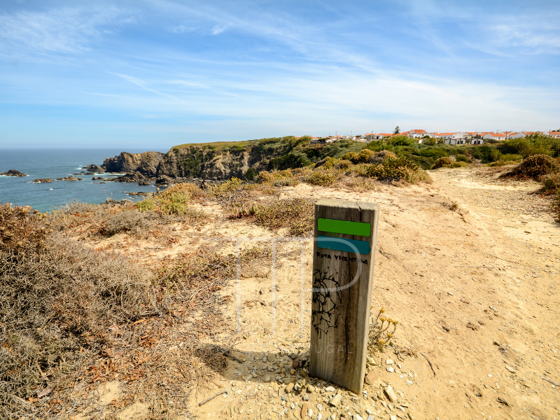
The thunder of the Atlantic breakers is a constant companion on the entire fishing trail, as the path always leads directly over the cliffs, through the dunes and sometimes even over the sandy beaches.
Hiking on the fishing trail: untouched nature and dizzying heights
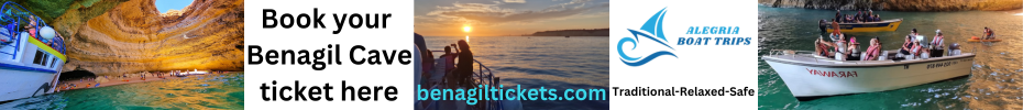
“You really are walking by the sea all day long,” says Carmelo, a pensioner from Huesca, Spain. That’s a good thing, because there is hardly any shade on the route. At least the fresh sea breeze cools you down a little. Sometimes, however, the narrow sandy paths are too close to the cliffs, some of which are up to 30 meters high. “You shouldn’t be afraid of heights on this hiking trail,” says Carmelo.
He and his wife Adelina may want to walk the entire fishing trail to Lagos on the Algarve coast – that would be a distance of 216 kilometers, spread over 13 stages. They have not yet decided. But one thing is certain: they are enthusiastic.
The retired couple hike regularly, especially on Spain’s St. James’ Way. But the hiking trail is special. On the Way of St. James, you always pass through small towns and sometimes have to walk on busy tarred roads. “But here, between the fishing villages, there is really only untouched nature. You don’t see any cars, no hotel castles. Just the sea, beaches, dunes and stunning cliff landscapes,” says Adelina.
How the Fishermen’s Trail began
There is a reason for the untouched nature of the Trilho dos Pescadores, which is best explained by the Swiss Rudolfo Müller: “The fishing trail runs through the Sudoeste Alentejano e Costa Vicentina Nature Park for almost its entire length.” It was Müller who brought the fishing trail to life in the first place.
In 1980, the farmer’s son from Aargau was traveling here on the south coast of Portugal on his motorcycle, fell in love and stayed. Müller soon began working as a hiking guide. “The potential of this region is simply incredible. The coastal landscape here is incredibly varied. No two daily stages are the same.” The only thing missing was a marked long-distance hiking route. Müller – who in the meantime had become the operator of the “Monte da Choça” hotel in the hinterland of the fishing village of Zambujeira do Mar – took on this challenge in 2008.
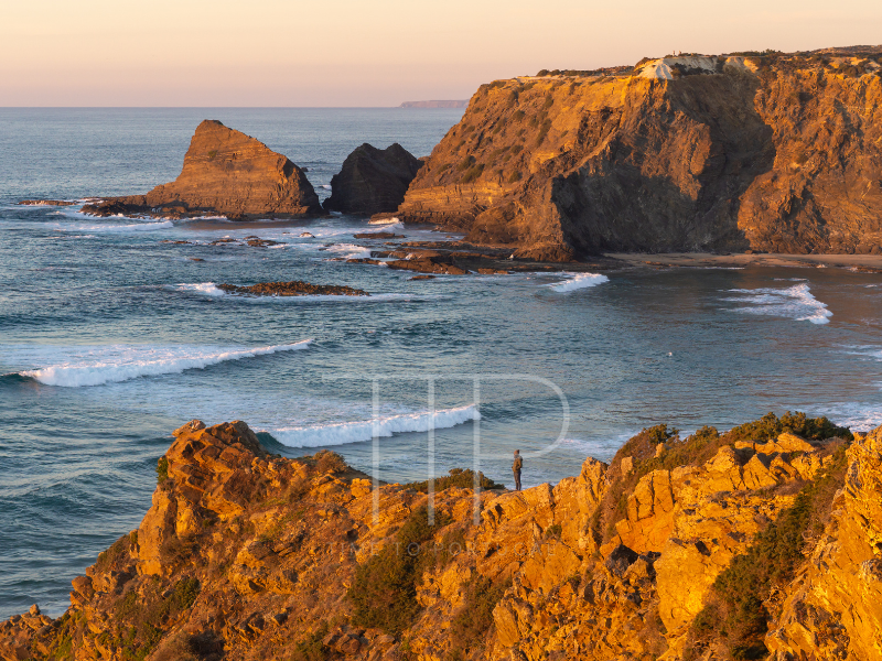
As a former hiking guide, he was able to assess which distances and routes were most suitable. Together with other members of the local rural hotel association, he initiated the Rota Vicentina, a network of hiking trails that also includes the fishing trail. They convinced local politicians and the regional governments of the Alentejo and the Algarve, through which the fishing trail now runs. In collaboration with the national park, the routes were defined and the long-distance hiking trail was equipped with blue-green stripe markings.
“The rest was already there. These are centuries-old paths that fishermen and barnacle collectors from the villages still use today to fish on the beaches and cliffs,” explains Müller. The fishing trail was opened in 2012 – with success.
The Fishermen’s Trail in Portugal: a natural highlight away from mass tourism
Even the initially skeptical locals are now largely convinced because the hikers spread the money across the entire coastal region – all year round. In the past, beach tourists only strayed into the area in summer. Restaurants, hotels, supermarkets, cafés – everyone benefits, they say. Even the cab drivers, who are increasingly taking care of luggage transport and tired hikers.
Nevertheless, hiking tourism has remained manageable compared to the Way of St. James, for example. There are no mass hikes here. And this despite the fact that some call the trail the most beautiful coastal hiking trail in the world. Which could well be true.
Perhaps the most beautiful coastal hiking trail in the world
After the Malhão surfing beach, the path leads into an untouched dune landscape. The landscape changes. The beaches give way to the mighty cliffs of Vila Nova de Milfontes, where fishermen cast their lines into the wild spray of the Atlantic.
The day ends with a cooling dip in the River Mira and local specialties and wines in the “Tasca do Celso”, a rustic wine bar in Vila Nova de Milfontes. The coastal village is a real eye-catcher with its whitewashed houses and the Fort São Clemente fortress built directly on the water.
Below the castle, the river can be crossed by a small ferry boat, saving hikers the long walk over the inland bridge. The following day’s stage to Almograve is quite short in comparison at 15 kilometers, but no less beautiful.
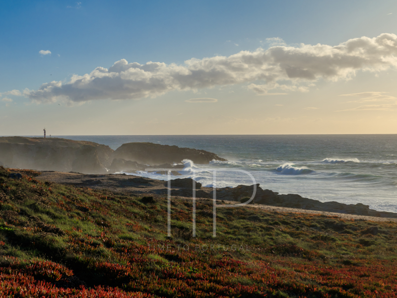
After the river, the route first leads through cork oak forests. Later in the dunes, midday flowers glow in yellow and pink, carnations in soft purple. Cistus roses, juniper and rosemary perfume the roadside until the path leads over Praia do Brejo Largo, the next dream beach, framed by wildly overgrown rocks.
On the Trilho dos Pescadores to Zambujeira do Mar
Anyone who thought that the steep cliffs couldn’t get any more mighty and impressive will be proven wrong the next day on the way to Zambujeira do Mar.
After the small fishing port of Lapa das Pombas, the dunes turn red, yellow and white. The rocky landscape becomes increasingly rugged. On the steep cliffs near the Cabo Sardão lighthouse, storks nest on the narrow rock slats that stretch down to the sea. Stone chats also live here – their song accompanies you throughout the day.
The path branches off to the country hotel “Herdade do Touril”, where a saltwater pool and hearty regional food revitalize tired bodies. From here, it’s not far to Zambujeira do Mar. The white coastal village is perched on a rocky cliff and is one of the most beautiful in the Alentejo.
A dip in the waves of the Atlantic
Morning mist makes the cliff landscape on the way to Odeceixe the following day even more mystical. After a few kilometers, the wildlife enclosure with ostriches and zebras that the path leads past seems surreal. Several bathing bays line the way to the fishing village of Azenha do Mar.
Now it’s not long to the Ponta em Branco viewpoint with its panoramic view of – how could it be otherwise – a beautiful beach. The section of the Trilho dos Pescadores that leads through the Alentejo region ends at Praia de Odeceixe. Here you have covered about half of the route. If you wish, you can continue walking and follow the coast of the Algarve to Lagos.
Or you can take off your rucksack and take a dip in the waves of the Atlantic. And if that’s too much turbulence for you, you can walk a few meters across the sandbank to the calmer side of the river, where the Ribeira de Seixe laps the beach from behind before flowing into the sea.
Further information on the fishing trail in Portugal
How to get there: Faro (Algarve) and Lisbon airports are the closest. Both ways take about 2 hours either by rental car or bus.
Hiking trail: The fishing trail is a relatively easy, well-signposted coastal path. However, walking in the sand is strenuous. You should be sure-footed and not afraid of heights. There is also an official luggage transport service.
Best time to visit: The fishing trail can be hiked all year round. The ideal months for hiking are April to June and September to November.
Accommodation: There are various accommodation options from campsites to youth hostels and charming country hotels.
Further information: The tourist offices of the Alentejo and Algarve regions can provide you with information about the two regions through which the fishing trail runs.
Interesting Travel News: Ryanair connecting Faro-Marrakech
[…] Related article: Hiking on the Fishermen’s Trail in Portugal […]
[…] Related article: Hiking on the Fishermen’s Trail in Portugal […]